








Scenic Drives Near Centerville, OH
When the temperatures begin to dip and the leaves on the trees start to turn, there’s no better time to go for a scenic drive and gaze at all Mother Nature has to offer. Not only do these scenic drives give you stunning vistas, but they also let you learn a little about the history of the area. Feel free to get out along the route, stretch your legs, and just enjoy the view. The outdoors are calling, so load up your new vehicle and hit the road to experience all these scenic drives near Centerville, OH have to offer.
Accommodation Line Scenic Byway
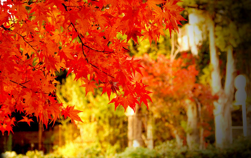
Image via Flickr by Pavel ahmed
Spanning about 12 miles, the Accommodation Line Scenic Byway isn’t so much about its length as what you can see along its route. It follows the early 19th-century Accommodation stagecoach route, and you can see historic towns and farms that dot the byway. Plan for a stop in Waynesville, which is dubbed the “Antique Capital of the Midwest,” for a self-guided tour of 40 historic buildings and 80 shops within five blocks.
Afterward, hit up one of two state parks: Little Miami State Park or Caesar Creek State Park. At Little Miami State Park, you can explore the area either by foot, bike, horse, or canoe. You’ll amble past Native American mounds, ancient gristmills, and historic buildings. Caesar Creek State Park features a 1,300-foot-long beach and offers excellent fishing and boating opportunities. It also has several trails that meander through the lake area.
Covered Bridges Byway
Ohio’s covered bridges are considered some of the state’s best-kept secrets. Begin your drive at the Netcher Bridge near Jefferson and continue your trek along the Smolen-Gulf Bridge near the Ashtabula River. You’ll find the country’s shortest bridge, which is the 18-foot-long West Liberty Covered Bridge, and the longest, with the 613-foot-long bridge that stretches State Road across the Ashtabula River. The route features 19 covered bridges, although you can only drive through 16 of them. The entire drive time should take about an hour.
Historic National Road – Ohio
This National Road is considered the road that helped build the nation and spans more than 220 miles. Commissioned by Congress in 1806, the road ran from Cumberland, MD through Vandalia, IL with the road cutting through Ohio constructed in the 1820s and 1830s. Today, you’ll recognize the road as Highway 40, but you can still glimpse how the roadway evolved from stagecoach to automobile.
Driving along this road you’ll cross original bridges and see historic buildings. These stone S-bridges are found at Fox Creek, Blaine Hill, and Salt Fork. The Blaine Hill Bridge has served travelers well for more than a century and is the state’s oldest bridge. It was recently renamed the state Bicentennial Bridge. Stop at the Pennsylvania House Museum, which is a restored tavern, and see where travelers ate after a long day on the road. The Heritage Center of Clark County features a National Road Gallery that highlights the history of the road and its impact on the area.
Hocking Hills Scenic Byway
The dense forests found in Hocking Hills provide some stunning views, especially in the fall when the leaves begin to change. Start in Centerville and take Route 56 toward Hocking State Forest. You’ll notice the forest headquarters, which was the Hocking County Honor Camp that housed prisoners who weren’t a flight risk during the 1930s. Once you get closer to the forest, you can check out four different routes that weave through Wayne National Forest or reach out past Lake Hope. The entire route of this tour spans 37 miles.
Lane of the Cross-Tipped Churches Scenic Byway
Head north of Centerville for the Lane of the Cross-Tipped Churches Scenic Byway. This farming region features numerous cross-tipped churches, all of which are on the National Register of Historic Places. St. Augustine Church, which was constructed in 1848, is one of the area’s oldest churches. New England settlers used the Greek Revival style when they built the First Presbyterian Church in Wapakoneta in 1862. You’ll also notice Romanesque Revival style in the rounded arches found on St. Joseph’s Catholic Church.
Other noteworthy sites along the 38-mile route include the National Marian Shrine of the Holy Relics and the New Knoxville Historical Museum. Step outside your vehicle and get some fresh air at the Miami-Erie Canal Towpath, which is a breathtaking 3.5-mile hiking trail that runs from St. Mary’s Memorial Park to Forty Acre Pond.
Lower Valley Pike Scenic Byway
This 11-mile scenic byway runs between the Mad River and limestone cliffs. You can enjoy a boat, tube, or canoe ride down the river, or try to catch a few fish. Another must-visit spot is George Rogers Clark Park, which provides 250 acres of meadows and shade trees where you can eat your picnic lunch. The park also houses Hosterman Lake where you can fish without a license. You might also catch a glimpse of the many types of wildlife that call the park home. It’s also the site of the largest Revolutionary War battle west of the Allegheny Mountains.
Miami and Erie Canal Scenic Byway
This route, which runs for about 50 miles north of Centerville, was developed parallel to the Miami and Erie Canal. Even though the canal was only in operation from 1840 through 1860 before railroads took over, its history remains evident in the area. Many of the hiking and walking trails were shaped from old towpath trails, which were paths that draft animals made when they towed the boats. You can also take a canal boat ride at the Johnston Farm and Indian Agency.
Pack up your vehicle and hit the road for one of these amazing scenic drives near Centerville. What do you think of this list of places to see from Performance Chrysler Jeep Dodge Ram Centerville? Did we highlight all the must-drive locations, or did we forget any? If so, make sure you contact us so we can add it to our list. We want everyone to see all the area has to offer.


0 comment(s) so far on Scenic Drives Near Centerville, OH